Mobile mapping. Point clouds. Data processing.
We create precise, consistent maps and “digital twins” from multi‑sensor system (MSS) data — as a basis for office surveying, GIS, CAD and BIM.
Who we are
DataDEV specializes in processing and analyzing mobile mapping data (MSS). Over the past years, hundreds of projects have been delivered — especially for road and rail infrastructure.
Focus: Georeferencing, classification, feature extraction, GIS/CAD/BIM deliverables.

Services at a glance
From MSS data we produce accurate, standards‑compliant results — from georeferencing to object modeling and delivery in the DataDEV-Viewer.
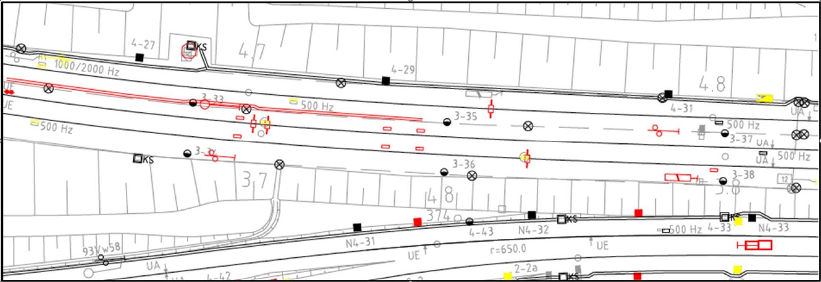
Mobile mapping for road & rail
Evaluations for roads (surface, markings, lighting, …) and rail (e.g., DB guideline 883/885), including profiles, clearance gauges and topographic derivatives.
Georeferencing & classification
GNSS/IMU/SLAM processing, registration to control points and classifications (ground, vegetation, noise, objects) — expandable depending on project needs.
GIS, CAD & BIM
Feature extraction from point clouds & images and export to standard formats — aligned with standards, accuracies and customer-specific requirements.
AI & automation
Detection of specific assets, road condition assessment, anonymization (faces/license plates) and AI‑assisted extractions (e.g., markings, signs, lighting).
DataDEV-Viewer
Access, organize and visualize MSS data in the browser — ideal for collaboration without specialized software. Integration of existing GIS/CAD/BIM datasets is possible.
Manufacturers & systems
We process data from various vendors, including Trimble, Riegl, Leica, NavVis, TLS as well as in‑house developments.
Accurate data — easy to share
We combine semi‑automatic and automatic workflows for fast extraction of many object types and for delivering the data to many parallel users.
- Point cloud preprocessing & registration
- Feature extraction (road/rail assets, equipment, surroundings)
- Standard formats for planning, operations and documentation
- Browser-based collaboration with DataDEV-Viewer