Services
From georeferencing to classification and feature extraction through to browser delivery: DataDEV supports you across the complete processing chain for point cloud and image data.
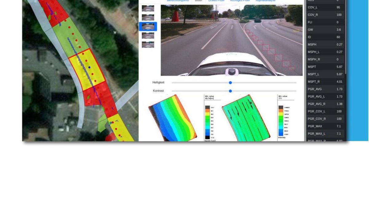
Mobile mapping – road
- Surface determination & condition assessment
- Object modeling (e.g., road markings, curbs/edges)
- Lighting inventory & traffic assets
- Special analyses (e.g., basis for FTTx planning, autonomous driving)
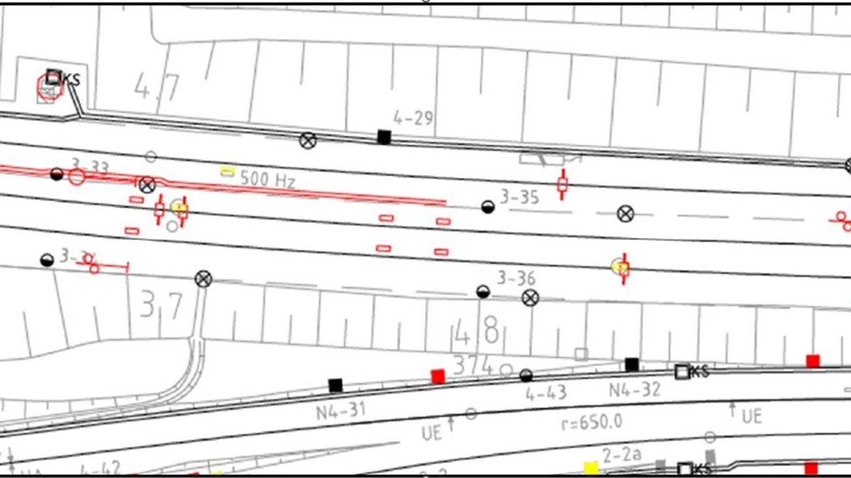
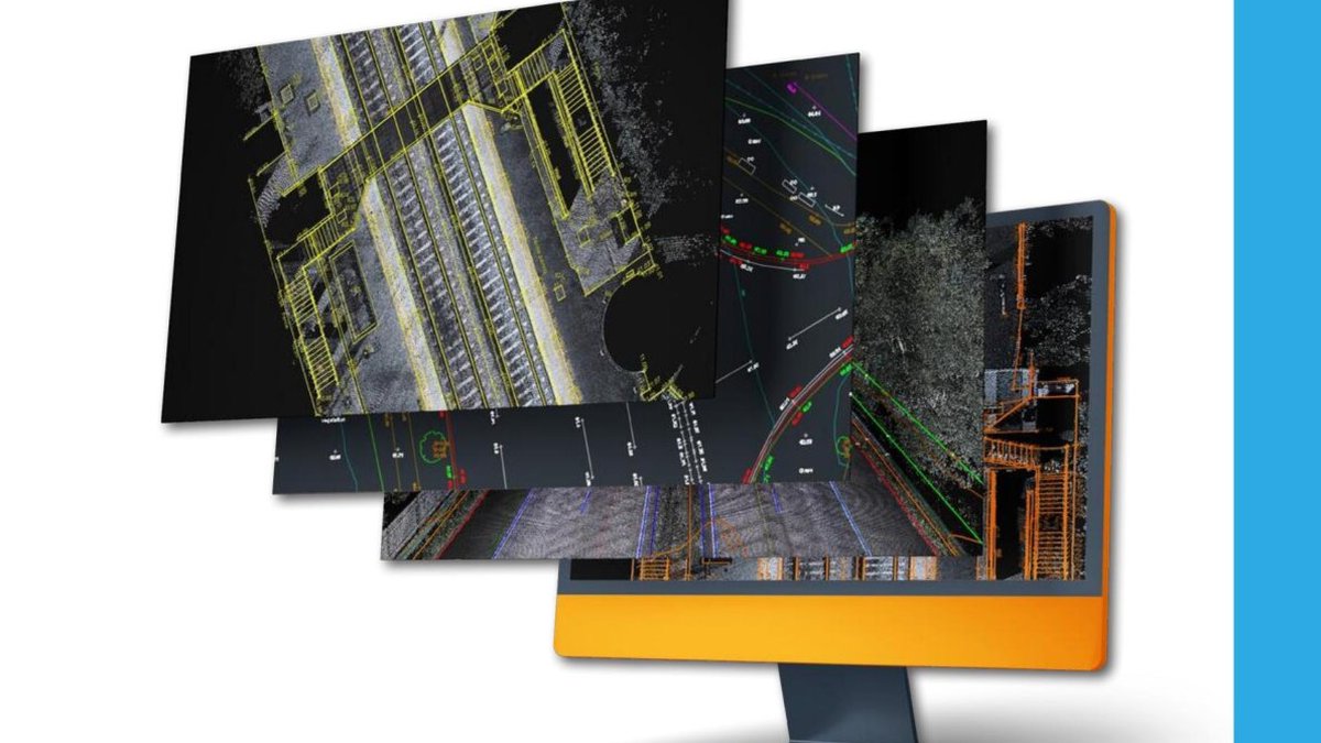
Mobile mapping – rail
- MSS evaluations compliant with DB guidelines 883/885
- Georeferencing to GVP, track axis & constraint points
- Profiles, clearance gauges, topographic evaluations
- BIM modeling & DUA planning (project-dependent)
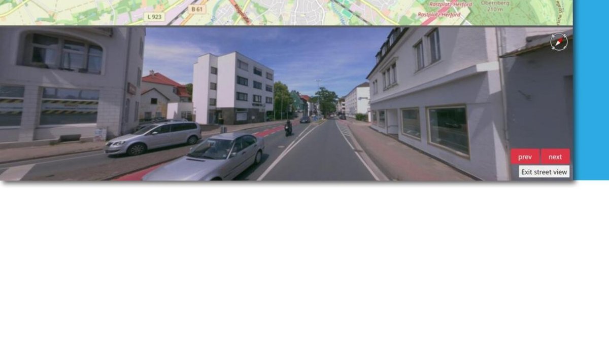
Data delivery – DataDEV-Viewer
In the browser: organize projects, visualize data and share with your team — without specialized software. Existing GIS/CAD/BIM data can be integrated.
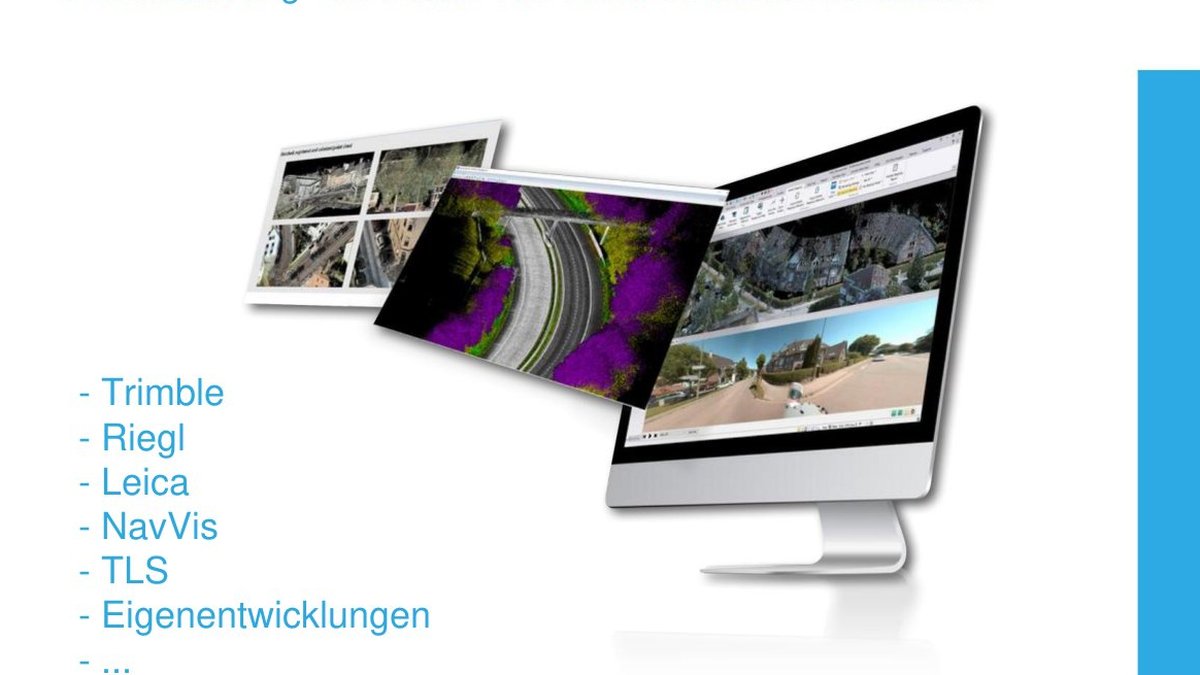
Georeferencing & registration
GNSS/IMU/SLAM processing, registration to control points and project-specific accuracy requirements (e.g., millimeter range in the rail environment).
- Point cloud registration (multiple runs / multiple scans)
- Control measurements & quality assurance
- Project-specific accuracy reports
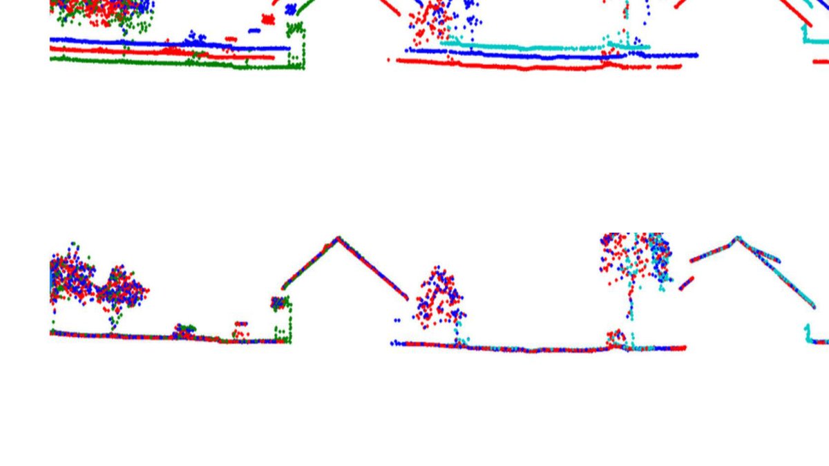
Classification & feature extraction
We classify point clouds (ground, vegetation, noise, …) and extract assets for road and rail environments — including attribution for databases.
- Road: edges, signs, lighting, trees, cabinets …
- Rail: tracks, platforms, equipment (e.g., balises), signals …
- Vector data + attributes for analysis & planning
GIS / CAD / BIM
Objects are modeled from point clouds and imagery and delivered in standard formats — compliant with standards and defined accuracy.
- Planning and GIS derivations
- 3D object modeling
- BIM models (project-dependent)
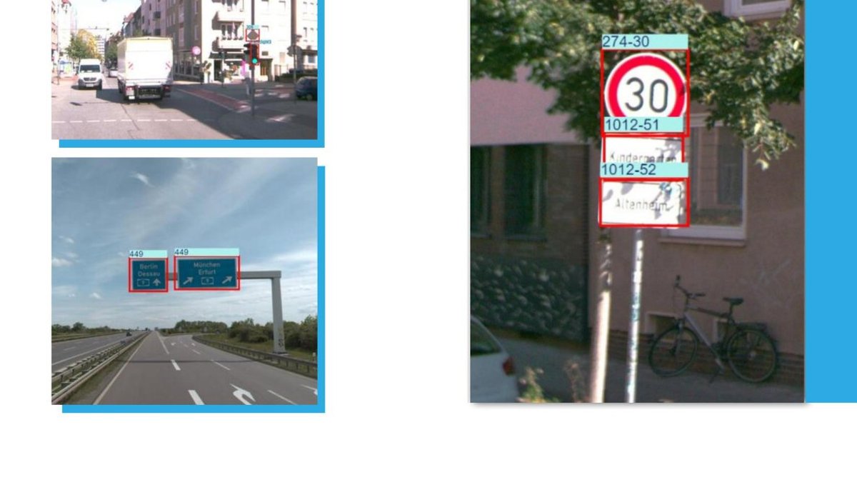
AI modules
Our own AI workflows support automated detection and assessment — including privacy functions.
- Road condition assessment incl. damage analysis
- Extraction: traffic lights, road signs, lighting
- Extraction: road markings
- Anonymization: face & license plate detection/blur
- Extraction of road surfaces from images (3D polygons)